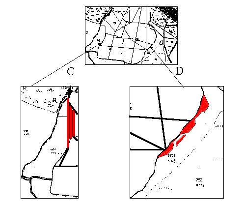
Site C has three different levels of terrace, one running almost the complete length of the inlet. Site D on the other hand appears to contain an island jetty which allows vessels to birth and turn with the minimum effort. These sites are currently completely overgrown with vegetation, needing clearance and detailed examination.
Each of these jetties, as I have called them, is connected to the other by a series of tracks, forming a veritable network of inter-connections. These lead from each berth to the other, and from there via a number of routes to the local Bloomeries.

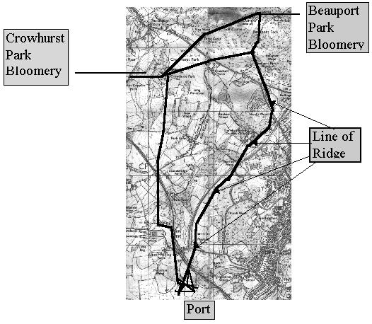
Route of Roman track to the Hastings port
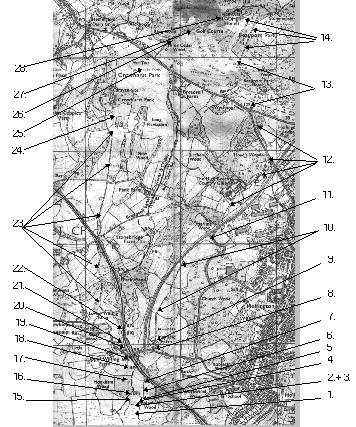
This map shows the route taken from Beauport Park and Crowhurst Park to the deep water berths at Bulverhythe. As well as visual evidence provided using the Margary method further evidence can be provided by study of the 1844 tithe map of Hollington.
There are a number of visible reference points as follows:
1. Crop leaves track marking in early Summer in Sandrock Field (see photo in Annex)
2. Field boundary cut through at point of entrance
3. Paving of ironstone and smelted waste (see photos on pages 100 and 101)
4. Terrace crosses field (see photo in Annex)
5. Remains of track crosses pond before entering hedge
6. Gap in hedge where track crosses
7. Track cuts across edge of pond, rampart collapsed into pond
8. Crossroads at Mayfield Farm, southern track now abandoned
9. Track passes Mayfield Farm connecting with old ridge footpath
10. Track follows field boundaries
11. Excavation reveals cinder type material at appx 18”
12. Track follows field boundaries to Beauport Park golf club
13 Track lost on golf course
14. Track runs through woods to bloomery
15. Cuts down side of embankment
16. Can be seen appx five yards past field boundary as you enter MonkhamWood
17. Track follows right hand side of stream crossing 10 yds north of fork with
agger type mound running out through undergrowth.
18. Terrace runs across field. (see photo in Annex)
19. Mound as track crosses edge of field and through hedge
20. Terrace runs parallel to railway joining old track
21. Terrace runs through wood
22. Roman track carries on to top of mound then forks left to join footpath at
bottom of valley, detouring steep ravine.
23 Track follows field boundary to Crowhurst Park.
24. Earthen terrace visible at rear southern side of caravan park
25. Remains of metalling scattered through soil by ploughing
26. Track is visible between two more recent access routes
27. Track runs through edge of fairway appx 3 yards into wood ruts still visible
28. Enters excavation at west end of site.

NEXT PAGE
 RETURN TO INDEX


 LAST PAGE
 RETURN TO INDEX